Better flood maps are coming
Written by a la mode on February 4, 2015
Our InterFlood maps are changing for the better in the next few weeks.
With everything on our plate, you may wonder why we're changing maps at all. The simple answer is that our flood map provider is eliminating the old scanned maps, so we had no choice. Nevertheless, it worked out well, giving us the opportunity to build a new digital flood map solution for you. When you see the new maps, we think you'll agree that they're much more modern and easier to read.
Advantages of these new InterFlood maps include:
- Up-to-the-minute data with the LOMR information from FEMA
- Your choice between aerial maps and street maps
- Easier readability for your clients with clearly marked streets
- A new legend with more details than the current maps
- No need to do anything differently — you'll just see better looking maps
- All the data flows into your forms exactly as before
Here are examples of the new street and aerial maps:
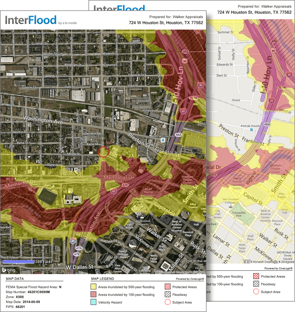
(Click here to see a larger image. Also, we chose the red overlay in this example, but you have five color options.)
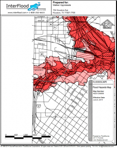
For reference, here's the same property in the current maps:

(Click here to see a larger map.)
We're confident you'll really like the new solution. The look is modern and the data is much better.
As usual, we'll let all of our InterFlood customers know before the switchover has been made. In the meantime, let us know if you have questions.
More resources:
- Visit www.InterFlood.com to check out our InterFlood subscriptions and learn more.
- Click here to watch the video "Zero-click flood maps". You'll see how easy it is to add flood maps to every report automatically.